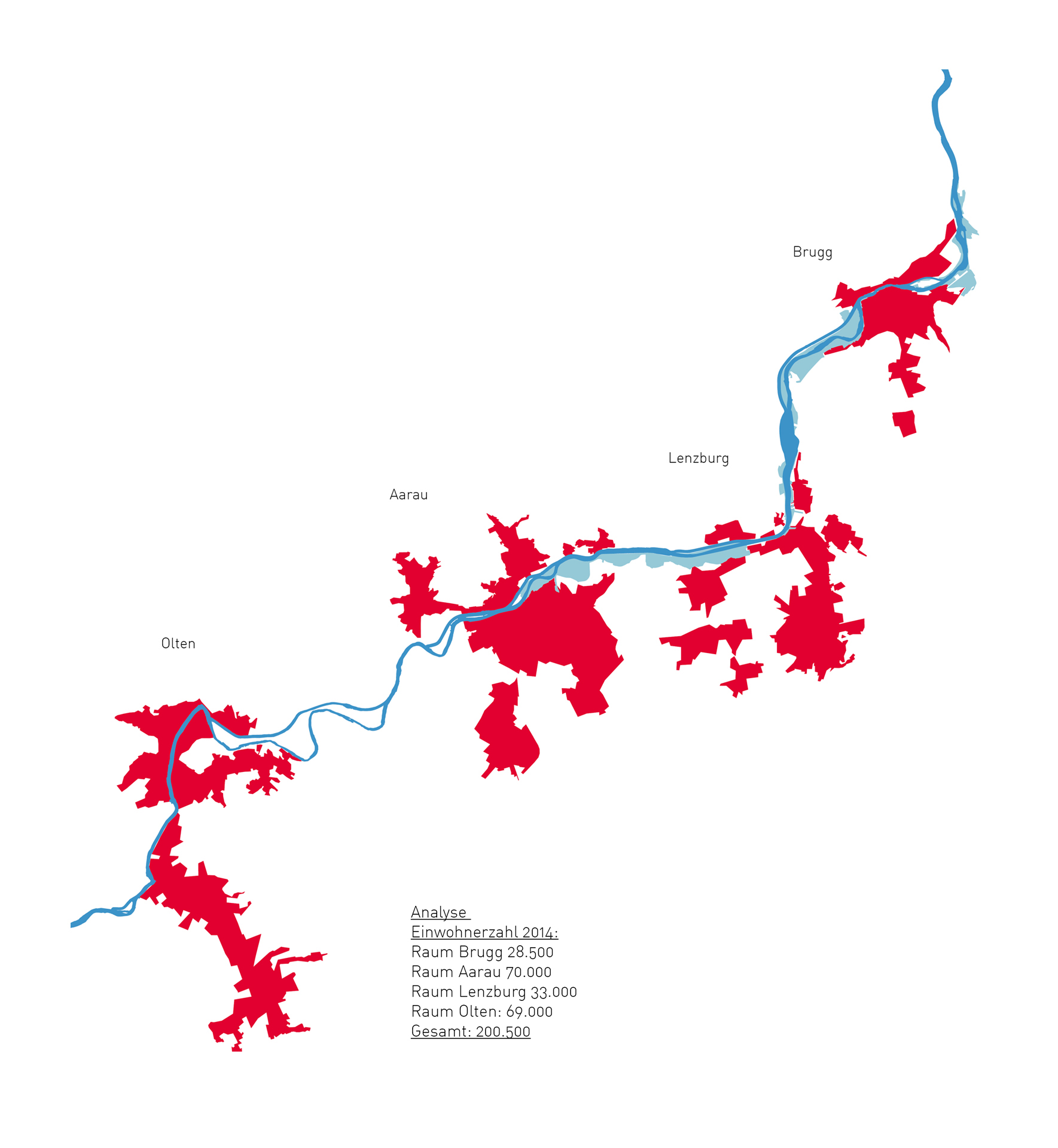
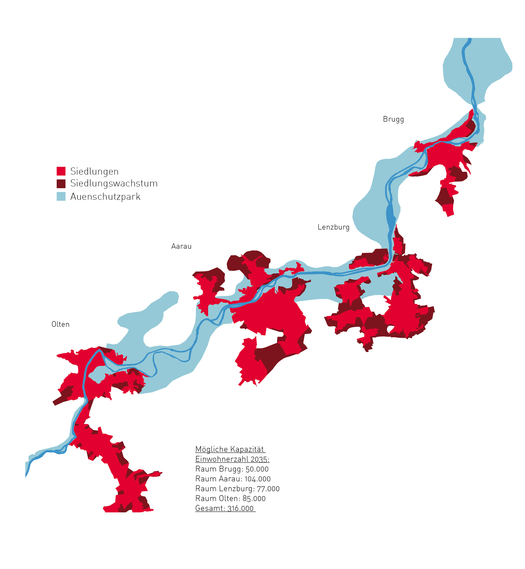
Strategie für eine synchrone Entwicklung von Landschafts- und Siedlungsraum. Offizielle Prognosen zeigen auf, dass die Bevölkerung im Kanton Aargau in den nächsten 20 Jahren markant wachsen wird. Die trotz Raumplanung stattfindende räumliche «Verbreiung» wird bei weiterem gleichmässigen Wachstum unsere Wurzeln – nämlich die Landschaft – unwiderruflich zerstören.
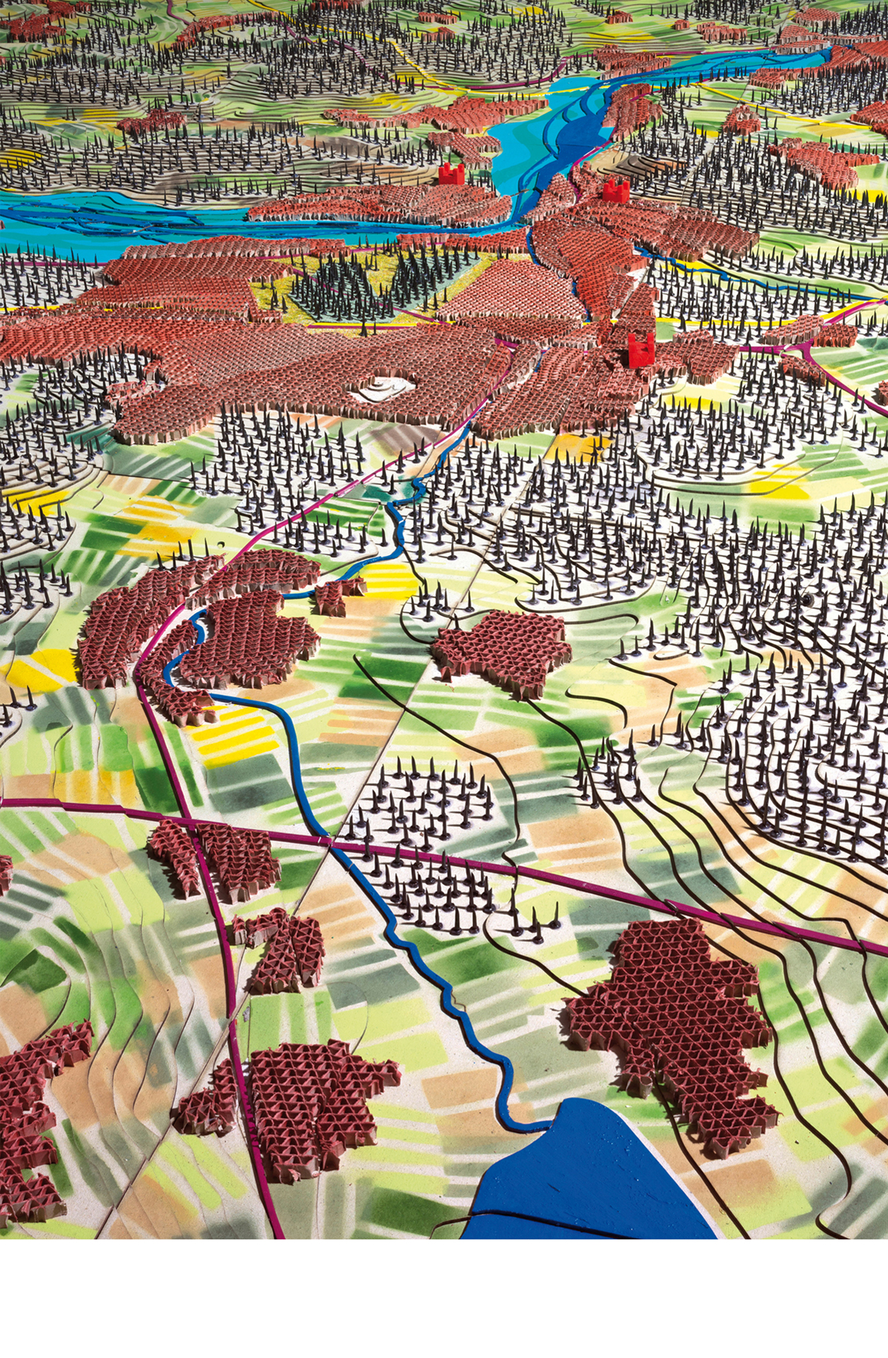
Ausgehend von einer Analyse der unterschiedlichen, den Aargau prägenden Landschaftsräume entwickelt die Gruppe Bibergeil alternative Entwicklungsstrategien. Sie zeigt modellhaft auf, wie sich mittels selektiven Wachstums Landschaft und Siedlung im Dialog gleichermassen entwickeln lassen und Identität stiftende Lebensräume geschaffen werden.
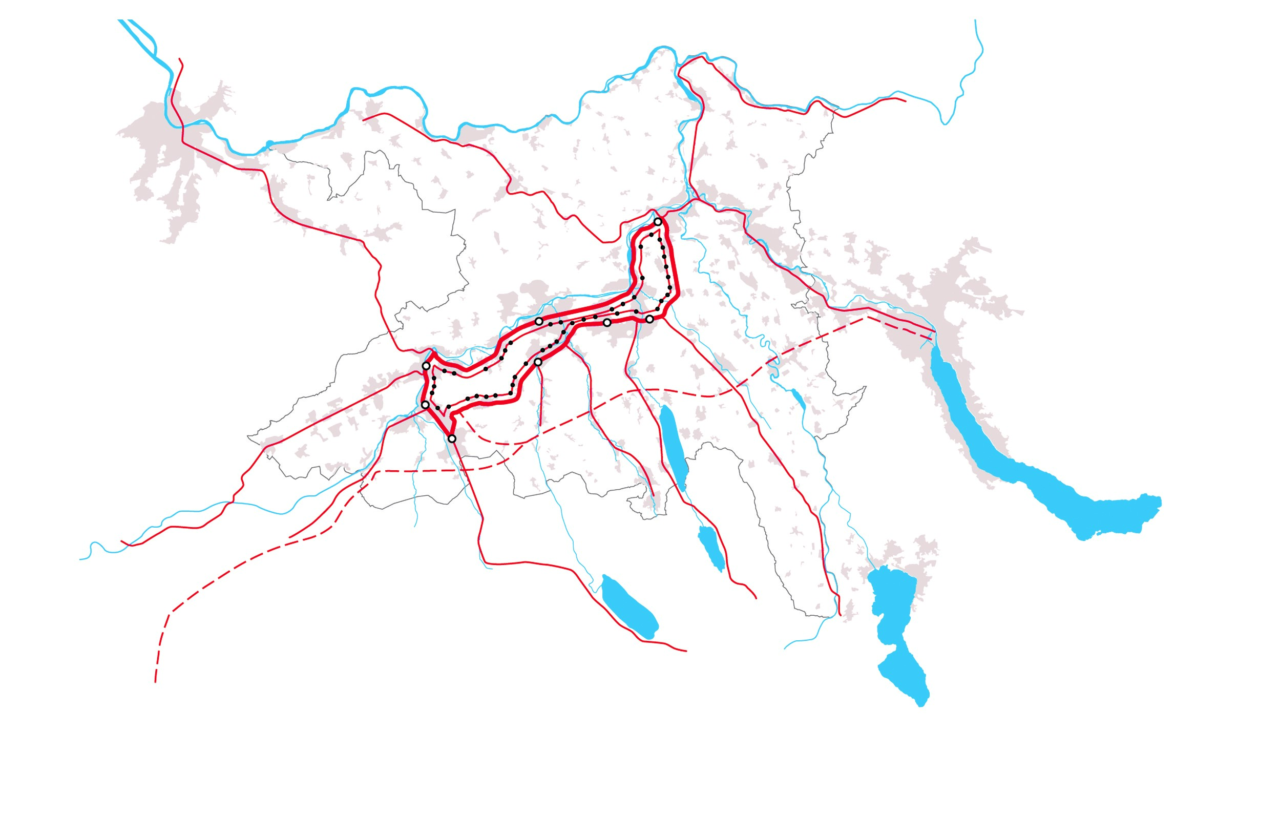
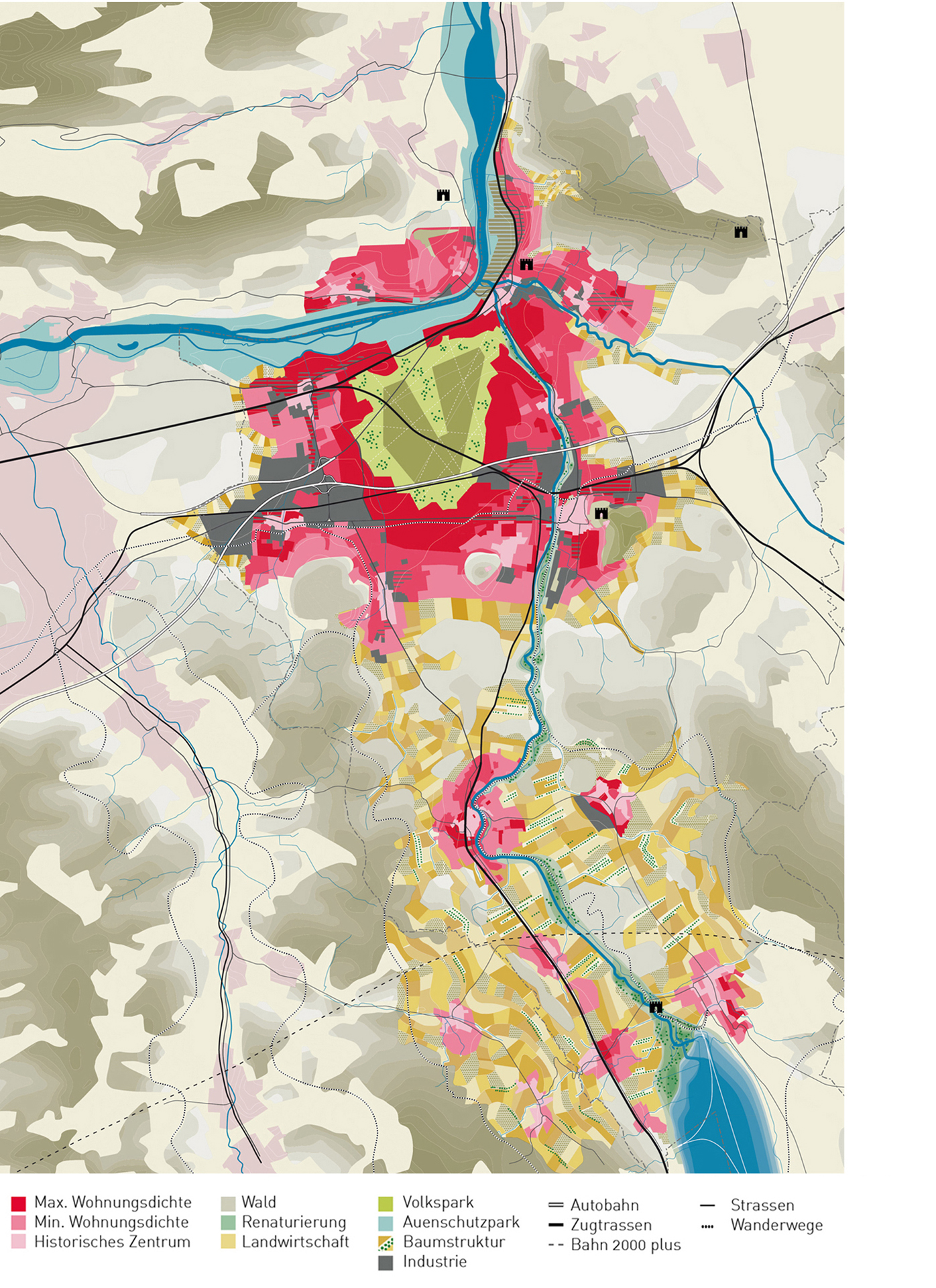
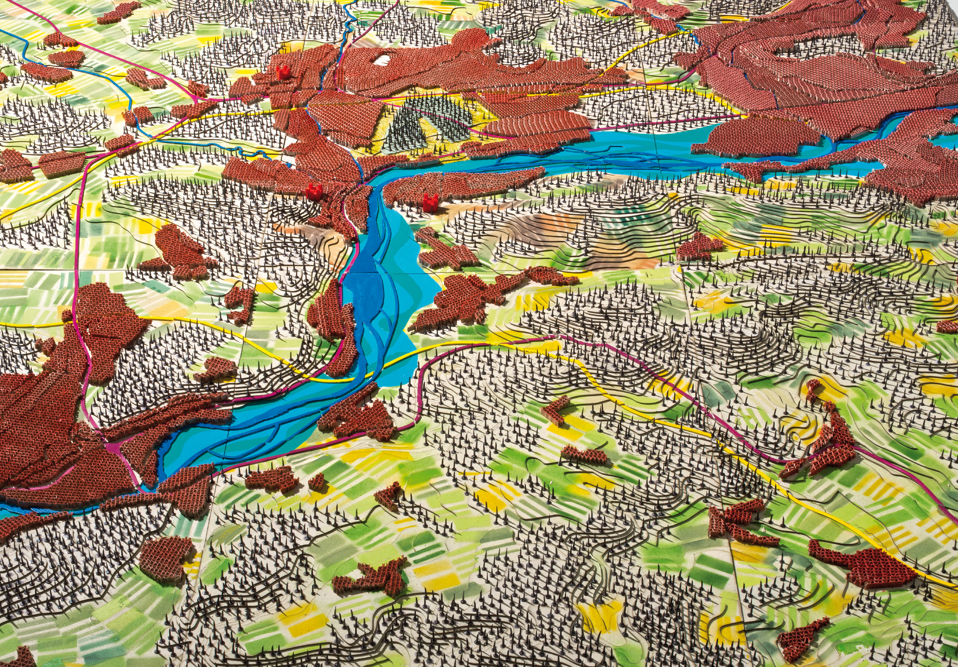
Von der Zersiedelung zum selektiven Wachstum: Die Gruppe Bibergeil – bestehend aus den Architektur- und Landschaftsarchitekturbüros Liechti Graf Zumsteg aus Brugg, Meier Leder aus Baden, Schneider & Schneider aus Aarau und Studio Vulkan aus Zürich – fordert eine spezifische und synchrone Entwicklung von Siedlung und Landschaft im Aargau. Mit Entwürfen wie dem Hero-Prinzip, der Städtekette oder der Waldstadt Lenzburg zeigen die Architekten und Landschaftsarchitekten in der Studie «Les Argovies – Identität des Dazwischen» auf, wie sich der Aargau räumlich entwickeln soll.
Ort: Kanton Aargau, Schweiz
Studie: 2015–
Gruppe Bibergeil: Liechti Graf Zumsteg Brugg, Meier Leder Baden, Schneider & Schneider Aarau und Studio Vulkan Zürich
Beratung Verkehr: Stadt Raum Verkehr Zürich
Official prognoses indicate a marked rise in the population of the Canton of Aargau within the next 20 years. If the rate of growth continues steadily, the urban sprawl taking place in spite of land-use planning efforts will lead to irrevocable destruction of our roots – namely the landscape.
Based on an analysis of the different landscape regions characterising the Aargau area, the Bibergeil Group evolved alternative development strategies. The group exemplifies how selective growth can be used to develop both landscape and settlement in dialogue with each other and how identity-generating living environments can be created.
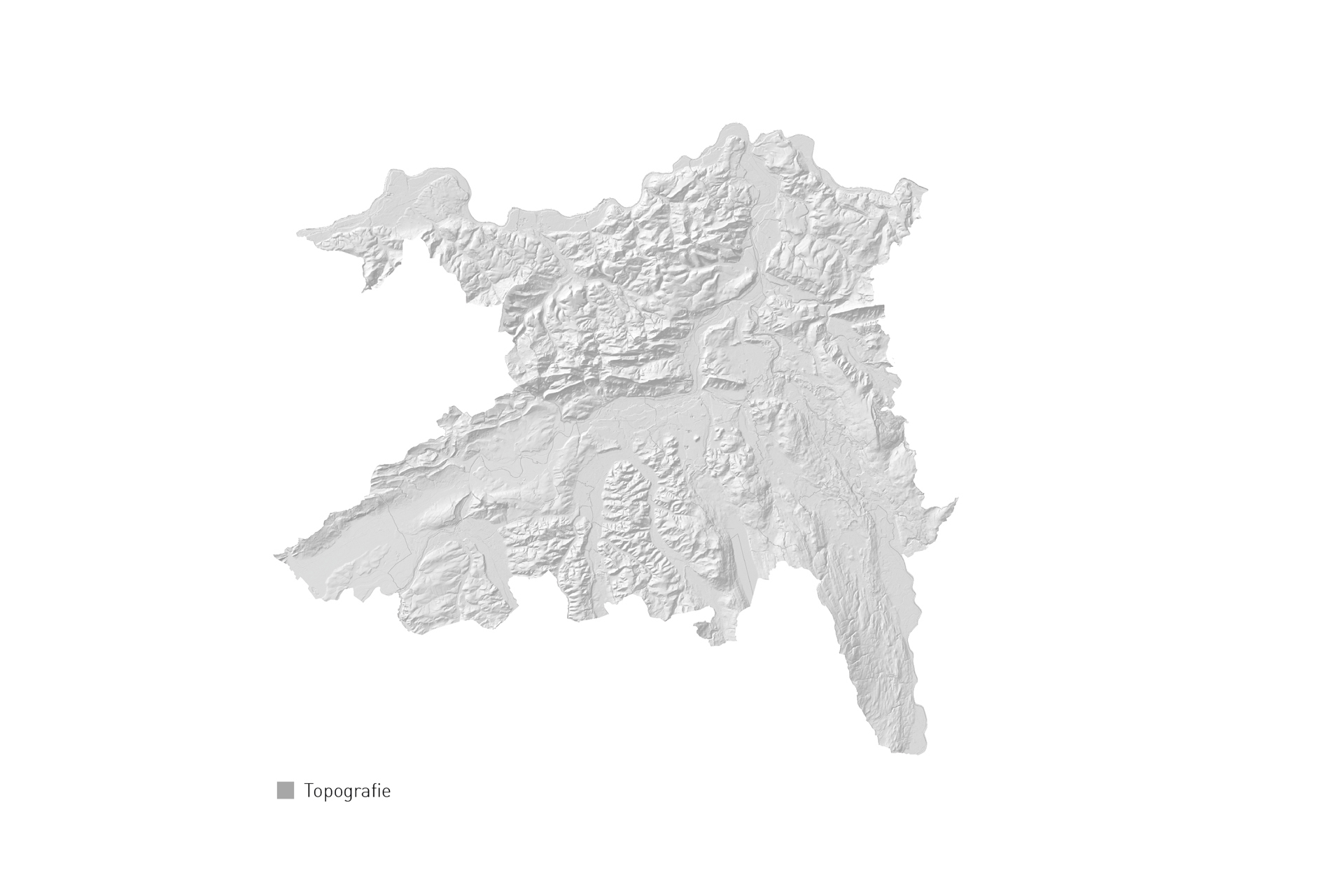
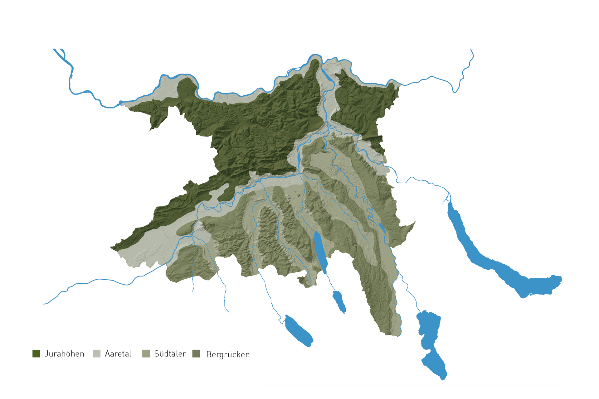
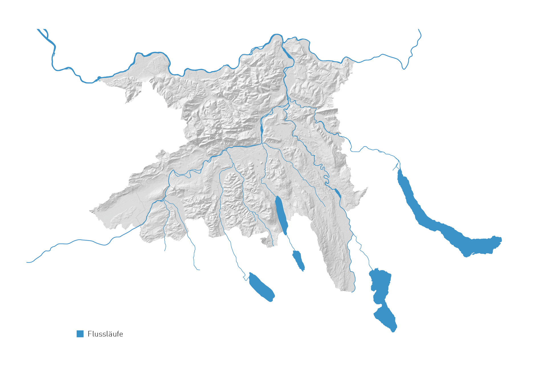
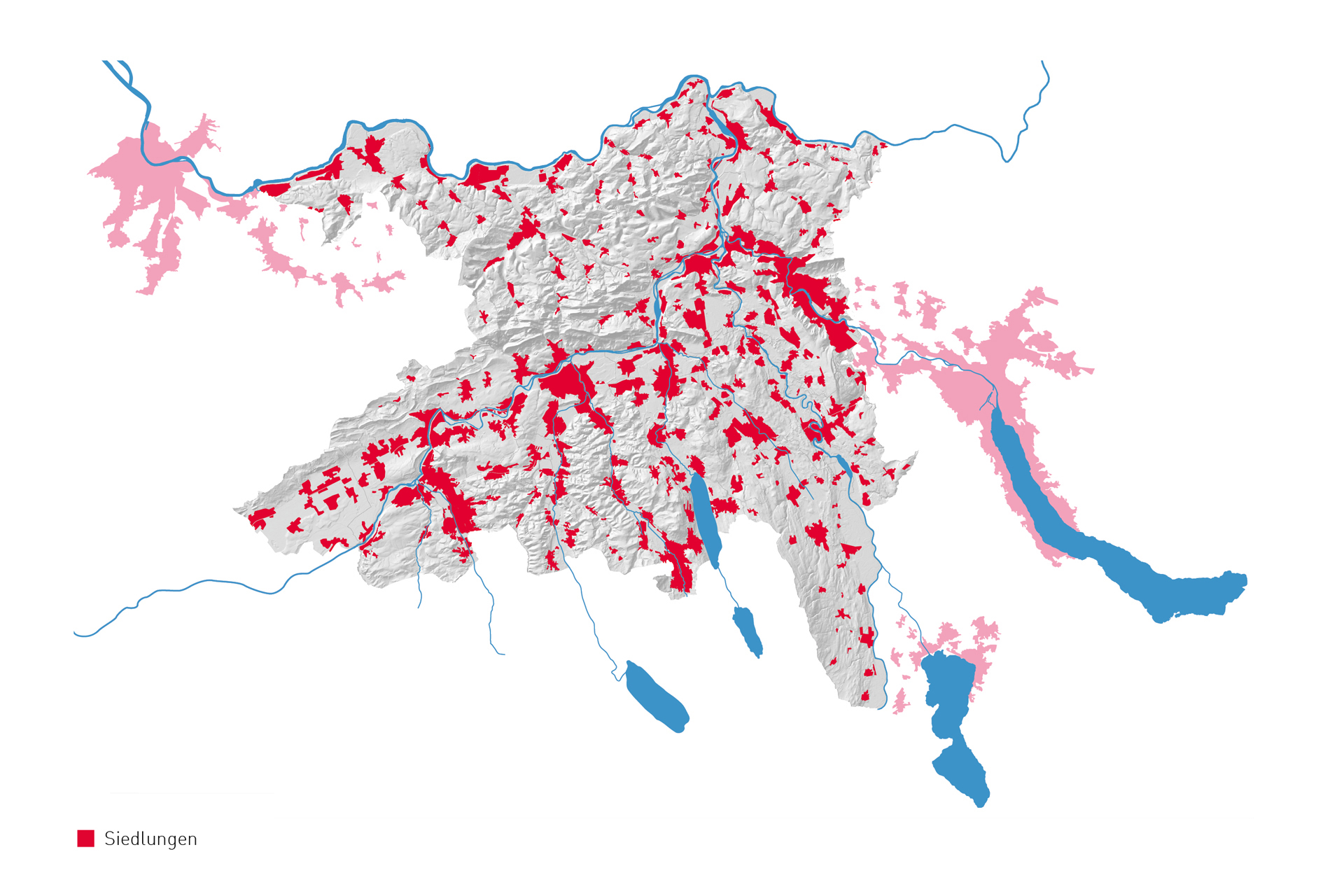
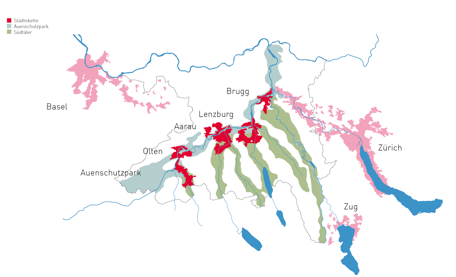
The water and glaciers have created a small-scale landscape with a specific structure. The rivers at the moated castle with Aare, Reuss and Limmat cut through Jura to reach Rhine. A series of southern valleys descend from Aare, and are separated from each other by ridges.
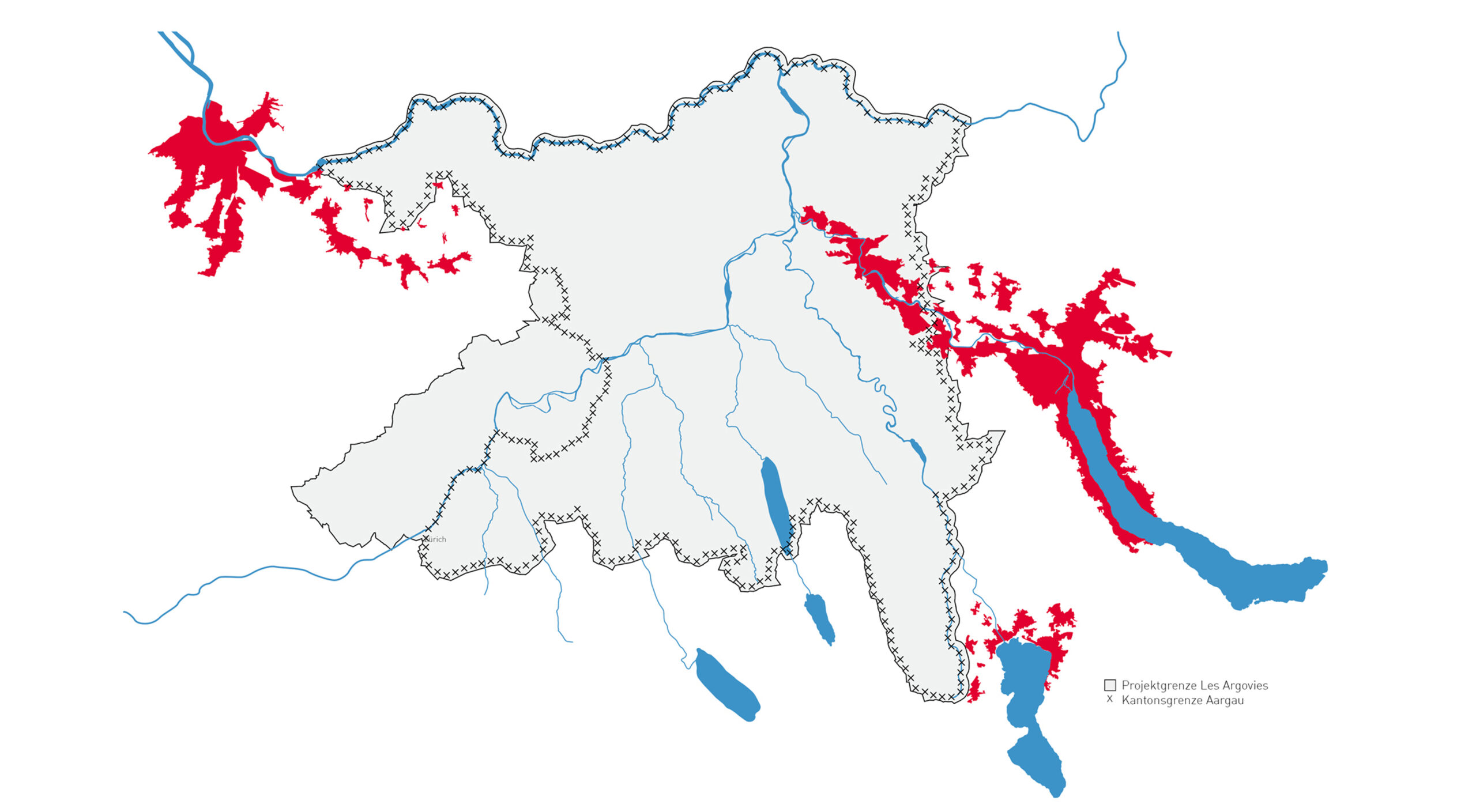
Settlement and traffic infrastructures have integrated themselves into this topographical structure over the course of time and stand in a pronounced relation to this landscape. In contrast, the two adjoining metropolises of Zurich and Basel spread across the landscape and stretch their tentacles along the valleys into Aargau.
As a counterpoint to the urban areas, we see the potential of Aargau in the preservation and further development of the existing landscape qualities, and also in finding the identity of its own.