November 7, 2025
2649 Urban Area Basel East
2649 Urban Area Basel East
Location:
Basel, Switzerland
Project Type:
Design Study
Project Period:
2023
Client:
Canton of Basel-Stadt
Planning Team:
Studio Vulkan, Hosoya Schaefer Architects, membrive, Sociology & Space Barbara Emmenegger, Oeplan
Photography:
Studio Vulkan
Details:
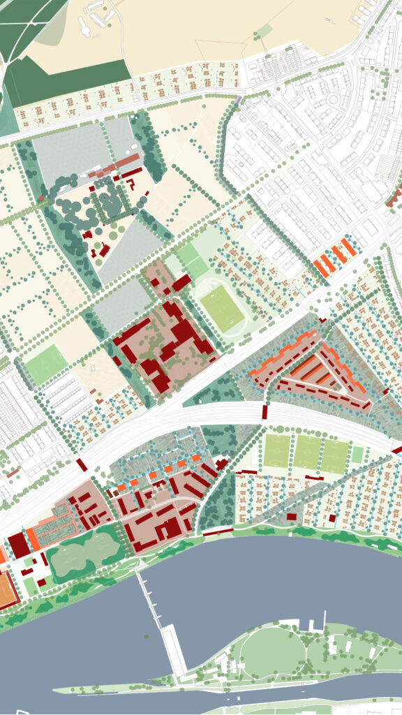
A Landscape Architectural Framework for Basel East
The area of Basel East is situated at the intersection of contrasting spatial and developmental dynamics. On one side, it is framed by the natural landscapes of the Rhine and the Wiese Landscape Park; on the other, it borders
rapidly expanding zones tied to the pharmaceutical industry and lies in close proximity to Basel’s city center. As surrounding developments intensify, settlement pressure on the area continues to increase.
Currently, a heterogeneous mix of uses coexist largely without cohesion: a car-oriented main road, isolated settlement fragments, allotment gardens, agricultural lands, and sports facilities. These elements function independently, with little spatial or programmatic integration. The objective of the design study was to identify and define the spatial structure and identity of the area.
To enable a clearly defined negotiation process for the site’s future development, a robust spatial framework is required. This structure is envisioned as a network of bands with high ecological and public value – providing orientation within the space and establishing a coherent framework for further transformation. The protection of the area is anchored in the appreciation and responsible use of the soil. Productive land use at various scales – whether through agricultural fields or community gardens – forms the core identity of the site.
The fields are to be developed according to their respective potential. Development within these fields is subject to negotiation. A basic zoning concept emerges: the edges of the site are kept open and reserved for urban agriculture and gardens, while the central zone is shaped as a “blue band” following watercourses and integrating public infrastructure. Gardens, sports facilities, and residential uses are proposed for the central and eastern banks, whereas the western bank is designated primarily for recreational sports activities.